Lakeshore Valuation Using Vision 8 Land Details
We receive frequent requests to share our CAMA best practices with the Vision community and this month we are happy to provide our tips on valuing lakeshore properties! Read how the Vision Appraisal Team approaches valuing lakeshore properties using Vision 8!
We are going to share a few ways to value lakeshore properties. First, we will provide an overview on how Vision Users previously valued lake shore properties using the Frontage Field under the Land Details Screen, and then we will explore the new features such as the Front Foot Curve and the use of Property Factors within Vision 8.
Original Method for Valuing Shoreline Properties:
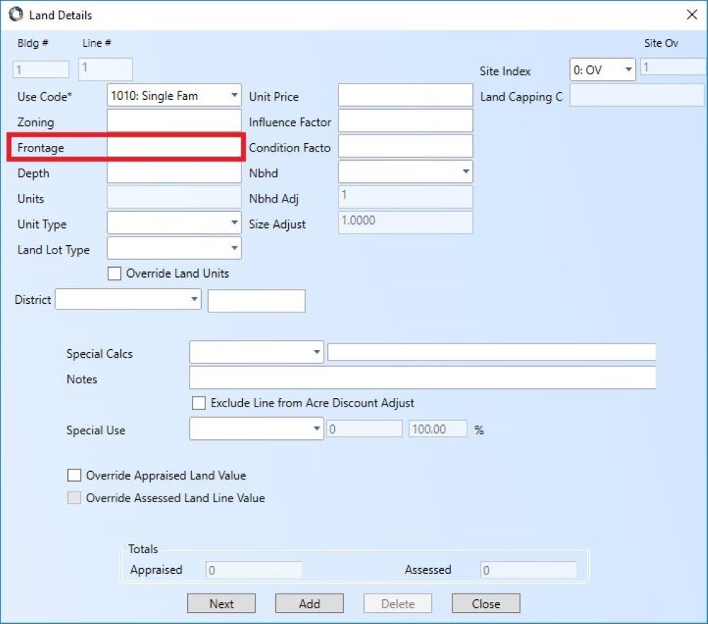
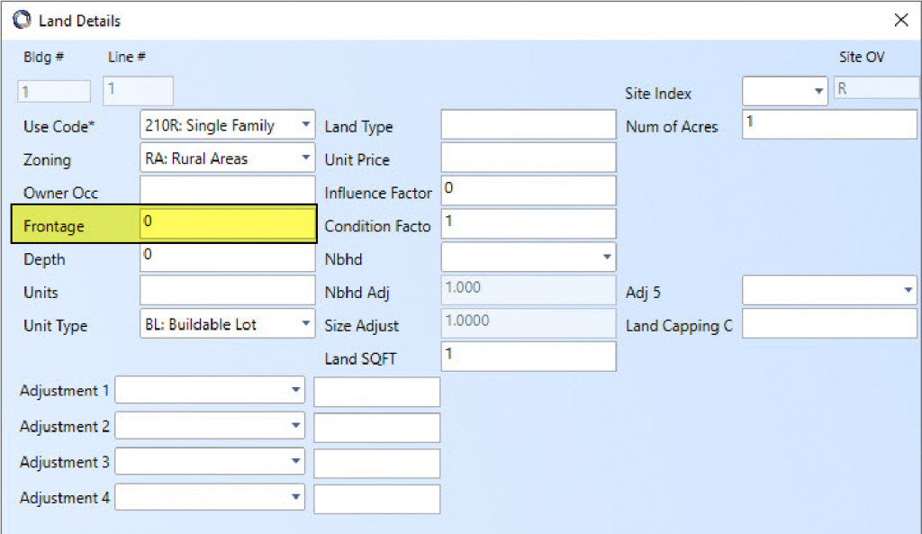
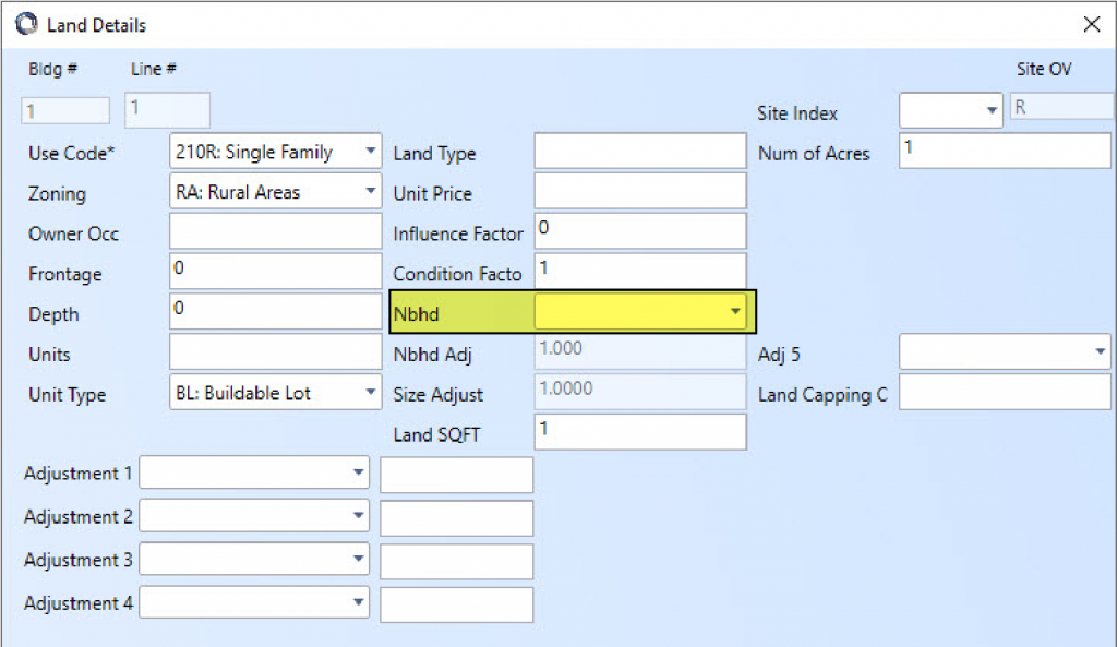
First you will enter the amount of shoreline frontage for each lakefront property in the Frontage field on the Land Details Screen. This field acts as a starting point for defining value because it helps determine what the typical frontage on the lake is. From here, you can develop a “discount” for lots with minimal frontage and a “plus” for lots with larger amounts of frontage.
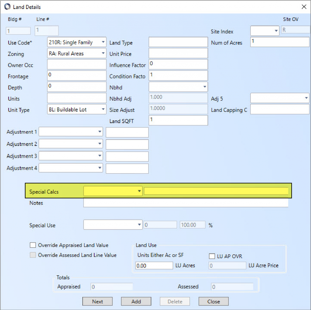
Special Calculation Codes:
The Special Calculation Codes field is used to create a lump sum or factor adjustment on the overall value of a land line. Special Calc Codes can be created for properties directly on the water or properties with a view of the water. These codes can be numbered to account for the various qualities of waterfrontage and views. The GIS and Mass Update modules allow the User to assign the Special Calculation Codes to a group of similar properties.
Example Waterfront Codes:
WF1 Prime Water Frontage
WF2 Good Water Frontage
WF3 Average Water Frontage
WF4 Marginal Water Frontage
Example Waterfront View Codes:
WV1 Excellent View (no obstruction)
WV2 Good View (minor obstruction)
WV3 Average View (some obstruction)
WV4 Fair View (partial view only)
The table entries should consider areas where good water access exists and the areas where swamp or mudflats limit the use of the frontage.
Additionally, the lots not directly on the water but with water views can be ranked to account for unimpeded or partially obstructed views. Through stratification of sale properties using Vision’s Sales Analysis Tool adjustments can be supported and associated with each code.
Neighborhood Delineation:
It is good practice to delineate neighborhoods and establish base land curves prior to establishing Waterfront, View and other Special Calc Codes. Tables should always be constructed that allow for both global changes as well as the ability to drill down to a specific location or attribute.
Photos to Reference:
While data collectors are visiting the sites, we recommend that they take a photo of the view from ground level or a first-floor deck/ patio and attach them to the property within CAMA. The photos become a point of reference for reviewing the grades of the view and for assigning an appropriate weight to the table once analysis is underway.
New Methods for Valuing Shoreline Properties
Feature: Vision 8 Front Foot Curve
The Front Foot Curve is a new feature within Vision 8. The Front Foot Curve is a streamlined way to assess waterfront properties based on their proximity to the lakeshore.
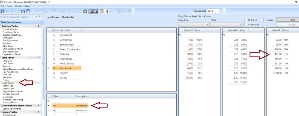
To use this feature, you first need to set up the Front Foot Curve in Vision Admin. Once you log into Vision Admin, select Table Maintenance then Parameter Tables then Valuation Switches. Under Calculation Settings & Switches select the Land Calculation Switches. Make sure to enable the Front Foot Curve by checking the box next to Use Front Foot Curve and click Apply.
After you enable Front Foot Curve, log into Vision CAMA and go to Table Maintenance then Land Tables and open the Land Curves Table. This is where you will build the Front Foot Curve. The system will reference the land lines frontage and apply the price from that point on the frontage curve.
Lastly you will go into Assessing Neighborhood Base Rates and point the selected Neighborhoods to the Front Foot Curve.
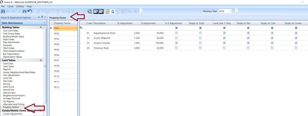
Feature: Property Factor Adjustments
Property Factors are located on the Classification & Land Information Screen. In the past these dropdown tables were informational only, however; in V8 we have tied these fields to the valuation tables. If frontage is not the driver of value for your waterfront properties, you can create a code for each body of water and assign a lump sum or factor adjustment to the land value.
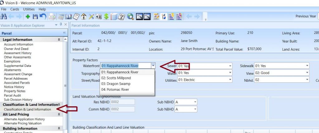
The Property Factors Table can be found in Table Maintenance / Land Tables / Property Factors. The user can assign a factor to the entire land value or just land line 1. The user can also assign the adjustment to the type of property the adjustment gets applied to such as Res, Com, Condo etc…